
Low unemployment
High unemployment
High unemployment
Colorblind friendly
off
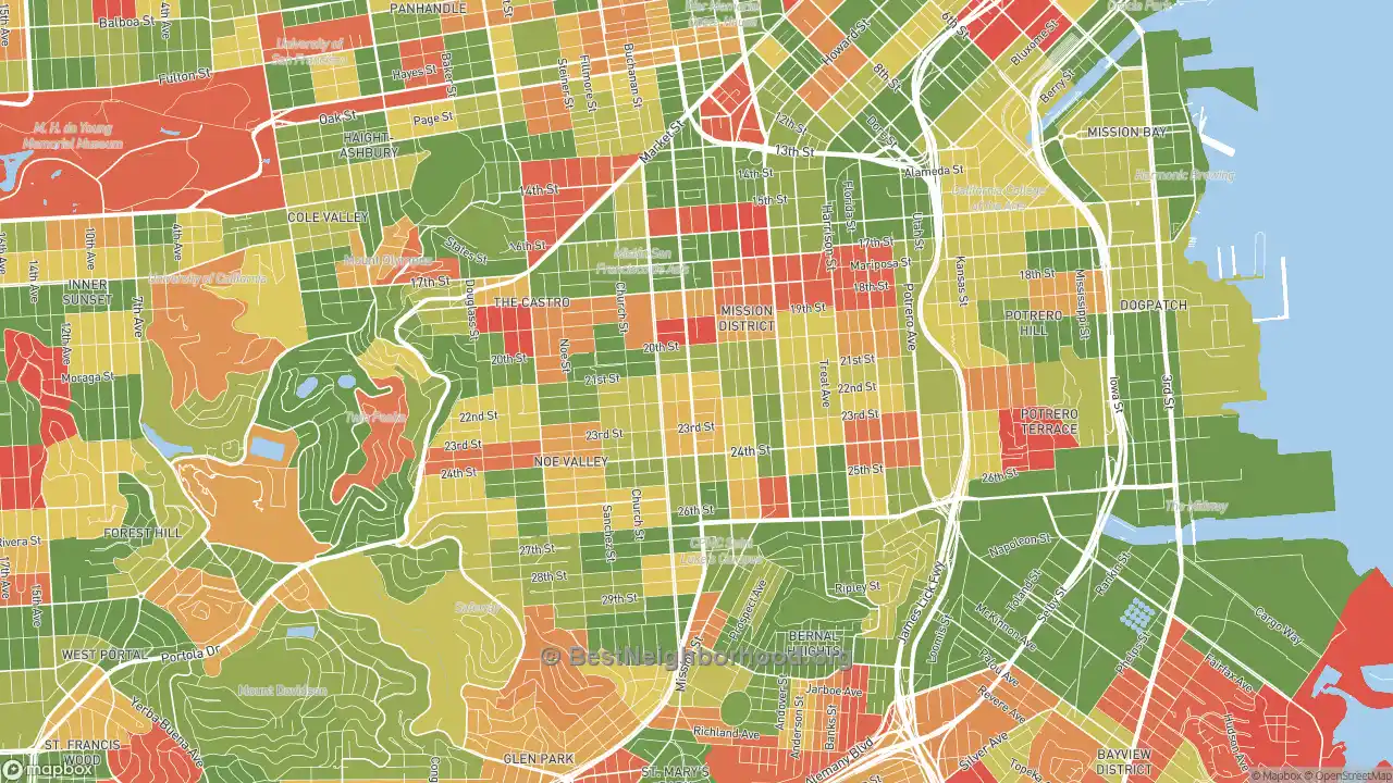
The employment rate in Liberty Street Historic District, San Francisco, CA, is currently 94.54%. On our map, you can see the unemployment rate by neighborhood. Red areas mean unemployment rates of 10-20% and higher, while the yellow range from 5-9%. Green areas of Liberty Street Historic District are 0-5%. These rates are based on working-age people in Liberty Street Historic District actively looking for non-military employment.
Nearby Neighborhoods
- Mission, San Francisco, CA
- Noe Valley, San Francisco, CA
- Castro-Upper Market, San Francisco, CA
- Duboce Triangle, San Francisco, CA
- Bernal Heights, San Francisco, CA
- Diamond Heights, San Francisco, CA
- Glen Park, San Francisco, CA
- Potrero, San Francisco, CA
- Twin Peaks, San Francisco, CA
- Cole Valley, San Francisco, CA
Neighborhoods with Similar Populations
- Lynn-Highland Park, Oakland, CA
- Independence Heights, Houston, TX
- Indiana University, Bloomington, IN
- Jordan, Minneapolis, MN
- La Homa, Mission, TX
- LaGrange, Toledo, OH
- Lakeview-Bakersfield, Bakersfield, CA
- Lakewood Village, Long Beach, CA
- Lauderdale Lakes West Gate, Lauderdale Lakes, FL
- Leimert Park, Los Angeles, CA
No other site shows detail at this level for free. We are able to keep this site free by receiving a small commission from the referring links on this page. Please share or cite this page if you aren’t able to otherwise support our work. Note that big changes are coming to this page in particular to add much more detail.
Updated 2023 using the most recent data available (2021)