
Best Neighborhoods in Kerrville, TX
2026–2027 edition · Data updated July 2026
Every neighborhood in and around Kerrville, scored on 40 measures of daily life and ranked to fit what matters to you. Several measures below read low, and the ranked lists name which ones. To work out which city fits you best, start with the best places to live tool.
Kerrville ranks 1,187th of 2,098 U.S. small cities on the BestNeighborhood index. It scores highest on quiet by a wide margin, and the cost of living against local pay is the weak spot.
Show off this ranking with the free Best Places to Live badge for your site.
Map of the best neighborhoods in Kerrville
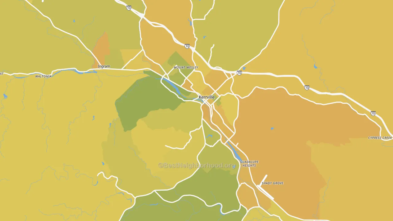
BestNeighborhood is the only ranking that scores 40 measures of daily life neighborhood by neighborhood and lets you re-weight every one of them yourself.
Kerrville's strengths and weaknesses
Where Kerrville ranks high
- QuietBetter than 94% of small cities
- Short commute18.5 minutes each way, better than 92% of small cities
- Disaster safetyBetter than 81% of small cities
- Nice weatherabout 129 pleasant days a year, better than 74% of small cities
- School gradeB+, better than 70% of small cities
Where Kerrville ranks low
- Cost of living vs incomeBetter than only 26% of small cities
- TransitBetter than only 13% of small cities
- Household income$70,022 median, better than only 22% of small cities
- Heat safetyBetter than only 8% of small cities
- Air qualityBetter than only 26% of small cities
What it costs to buy a home in Kerrville
A household needs to earn about $86,000 a year to comfortably buy the median Kerrville home, at 20% down and today's 30-year rate. That runs well above the area's median income of $70,022, so buying stretches a typical household.
Where the monthly payment goes
Assumes a 20% down payment, a 6.7% 30-year fixed rate, and a 28% share of income going to the payment. The rate is the 2026-08-20 30-year fixed average, series MORTGAGE30US from the St. Louis Fed, which publishes Freddie Mac's weekly survey. Against the median home value, property tax uses Kerrville's effective rate of 1.01%, and insurance is estimated at 0.4% of home value a year.
Renting versus buying
At today's prices, buying tends to cost more than renting for about the first 10 years, then pulls ahead as rent keeps rising and the mortgage builds equity. The chart tracks the running cost of each.
Who lives in Kerrville
Kerrville runs older than the country, and households here run smaller than average.
Residents by age
Racial and ethnic makeup has its own map. See the race and diversity map for Kerrville.
Who works in Kerrville, and how
Work in Kerrville centers on health care & social and retail trade. Unemployment is close to the national rate, and employment has held roughly flat.
Largest industries
How people get to work
- Drive or carpool 84%
- Work from home 9%
- Transit, walk, or bike 6%
Life in Kerrville
Kerrville has more restaurants and bars per resident than 86% of small cities and more parkland per resident than 84% of small cities. Dining, parks, and nightlife concentrates in some parts of Kerrville and thins out in others, which the map shows.
What the weather is like in Kerrville, month by month
Kerrville sees roughly 129 pleasant days a year. July highs average about 95 degrees. January highs sit near 63, with lows near 36. The comfortable stretch runs March through May, October, and November.
Show the monthly temperatures
| Month | Avg high | Avg | Avg low |
|---|---|---|---|
| January | 63° | 48° | 36° |
| April | 81° | 67° | 55° |
| July | 95° | 82° | 72° |
| October | 82° | 68° | 56° |
Flying in and out of Kerrville
San Antonio International sits about 54 miles away. It is a medium hub and boarded 5.3 million passengers in 2025, with 87 nonstop destinations.
The best schools in and around Kerrville
Schools across Kerrville average a B+, better than 70% of small cities.
Top elementary schools
- Harper ElA · 69% proficient
- Fred H Tally ElA · 65% proficient
- Ingram ElA− · 57% proficient
Top middle schools
- Ingram MiddleA · 66% proficient
- Harper MiddleB− · 50% proficient
- Peterson MiddleB− · 50% proficient
Top high schools
- Harper H SB+ · 61% proficient
- Hill Country H SB+ · 60% proficient
- Tivy H SB− · 53% proficient
Grades come from K-12 test scores, with scores projected for schools missing data. See every Kerrville school and its grade on SchoolGrade.
Kerrville measure by measure
Cards are ordered by how much each measure matters to you, so the ones you weighted highest come first. Expand to see every measure. Percentages compare Kerrville against the other 2,097 small cities.
Who Kerrville suits
Retirees
The weather beats 74% of small cities and it is quieter than 94%.
Common questions about living in Kerrville
Is Kerrville a good place to live?
Using BestNeighborhood's default rankings, Kerrville ranks 1,187th of 2,098 small cities. It scores highest on quiet, short commutes, and low disaster risk, and lowest on the cost of living against local pay and transit. How good it is for you depends on which of those you weight most, which the map lets you set.
Is Kerrville expensive to live in?
The median home is worth $317,587. The overall cost of living runs about 9% below the national average. Set against a $70,022 median income, cost of living beats 26% of small cities.
Is Kerrville safe?
Kerrville is safer than 42% of small cities. Safety varies a lot by neighborhood. Crime costs an estimated $420 per resident a year.
What is the weather like in Kerrville?
July highs average about 95 degrees, and January highs near 63 with lows near 36. That works out to about 129 pleasant days a year, more than 74% of small cities.
Is Kerrville good for families?
Schools beat 70% of small cities, crime safety beats 42%, and childcare runs $783 a month.
Compare Kerrville with other small cities
Sources and methodology
Every measure on this page is scored for each neighborhood, then rolled up to Kerrville. Scores are absolute rather than ranked, which means a 60 in Kerrville represents the same real quantity as a 60 anywhere else, and the ranking is a weighted average of those absolutes. The map colors come from a national scale calibrated against a population weighted random sample of 5,000 neighborhoods. That absolute scoring is what no other places-to-live ranking does: it puts a single neighborhood, a town, a metro, and a state on one scale, so the same 40 measures answer both which metro to move to and which street inside it to buy on. Read the full methodology.
Kerrville detail on BestNeighborhood maps:
- Walk Grade for Kerrville: walkability, transit, and biking, measured on the real street network rather than by straight line distance.
- Noise in Kerrville: road, rail, and aviation sound modeling calibrated against federal ground truth measurements.
- Conservative vs liberal map of Kerrville: precinct level election results apportioned to neighborhoods.
- Mobile and cell coverage in Kerrville: carrier by carrier coverage behind the cell score.
Kerrville detail on related sites:
- CrimeGrade: neighborhood crime rates behind the crime safety score.
- ISPreports.org: provider by provider internet availability and advertised speeds.
- CoverageWatch: the car insurance premiums behind the cheap car insurance score.
Federal and public data:
- U.S. Census Bureau American Community Survey: income, home value, rent, vacancy, commute time and mode, educational attainment, home age, age structure, household type, industry, and race.
- NOAA Global Surface Summary of the Day: the daily station record behind the monthly temperatures and the pleasant-day count.
- FAA Passenger Boarding Data: airport size and annual passenger counts.
- Freddie Mac Primary Mortgage Market Survey: the 30-year fixed rate used in the cost-to-buy estimate.
- FBI Crime Data Explorer: reported offenses behind the tangible crime cost estimate.
- U.S. EPA Air Quality System: five year average air quality index.
- FEMA National Risk Index: expected annual loss from natural hazards.
- CDC PLACES: disease burden, preventable risk, and barriers to care.
- National Center for Education Statistics: school enrollment and assessment inputs behind the school grade.
- FCC National Broadband Map: internet and wireless availability.
- U.S. Bureau of Labor Statistics: employment and job growth behind the local economy score.
- Religious activity uses a proprietary religious signal measurement.
Your priorities
Move a slider to say how much a measure matters. Zero turns it off.