
Teton Village, WY Flood Map
BestNeighborhood estimates that 3.7% of residents in Teton Village, about 1 in 27, live in a FEMA high-risk flood zone, compared with 2.6% in Wyoming and 5.6% nationwide.
The source of these figures is BestNeighborhood's flood model. It follows FEMA's flood maps wherever FEMA has studied the ground and fills the gaps they leave by learning from the zones FEMA drew on similar land nearby.
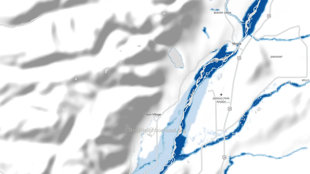
Who should care about this flood map?
This page is for people who live in Teton Village, or are thinking of moving there, and are concerned about large-scale flooding. It maps flood zones street by street and shows the 30-year chance of a flood and how many buildings carry flood insurance.
What this map counts as a flood
This map counts floods from rivers and creeks that leave their banks in Teton Village.
On FEMA's scale, the high-risk zone is the 1%-a-year zone, also called the 100-year floodplain, and 32 residents of Teton Village live in it.
In Teton Village, these figures follow FEMA's own flood zones wherever its digital map covers the ground.
Rain that floods streets and basements in Teton Village away from a waterway is outside this map.
How likely is a flood in Teton Village?
In FEMA's high-risk zone in Teton Village, a flood has a 1% or greater chance each year, or at least 1 in 4 over a 30-year mortgage.
| Flood zone | Chance in a year | Chance over 30 years | Teton Village residents | Wyoming residents | U.S. residents |
|---|---|---|---|---|---|
| High risk: Zone AE | 1% or more | about 1 in 4 or more | 3.7% | 2.6% | 5.6% |
| Behind a levee: Moderate-risk ground inside a levee system, which lowers the chance of a flood but does not remove it | 0.2% to 1% | about 1 in 17 to 1 in 4 | 2.8% | fewer than 1% | 2.3% |
| Minimal risk: Zone X | under 0.2% | under 1 in 17 | 94% | 73% | 83% |
What flooding looks like in Teton Village
In Teton Village, 3.7% of residents live in FEMA's high-risk flood zone, about two-thirds of the U.S. share of 5.6%. That zone holds 32 people, and each home in it has at least a 1 in 4 chance of a flood over a 30-year mortgage.
Levees in Teton Village
6.5% of residents in Teton Village live inside levee systems listed in the U.S. Army Corps of Engineers' National Levee Database. The part of that ground in FEMA's moderate-risk zone is home to 2.8% of residents. Levees lower the chance of a flood there but can be overtopped or fail.
Flood zones in Teton Village
FEMA's map of Teton Village shows three zones; its one lettered high-risk zone, AE, holds 3.7% of residents.
| Zone | Share of residents | What it means |
|---|---|---|
| AE | 3.7% | High risk, with flood heights published |
| X, inside a levee | 2.8% | Moderate-risk ground inside a levee system |
| X | 94% | Minimal risk, outside the 500-year floodplain |
Flood insurance in Teton Village
In Teton County, 3% of residential buildings carry a federal flood insurance policy, about the same as the U.S. share of 2.9%. Teton County has about 340 such policies in force.
Standard homeowners insurance does not cover flood damage, FEMA notes.
How current is the flood map in Teton Village?
Nearly every resident of Teton Village lives on a FEMA flood map panel that took effect in 2015, 11 years before this page's 2026 update. Across the U.S., half of residents live on a panel that took effect in 2013 or earlier.
How Teton Village compares
Within 33 miles of Teton Village, the share of residents in FEMA's high-risk zone runs from 1.2% in Wilson, WY to 6% in Jackson, WY, with Teton Village at 3.7%. Of the places closest to Teton Village in size, Hudson, WY has the most residents in the zone by share, 11%, against 3.2% in Warren Air Force Base, WY.
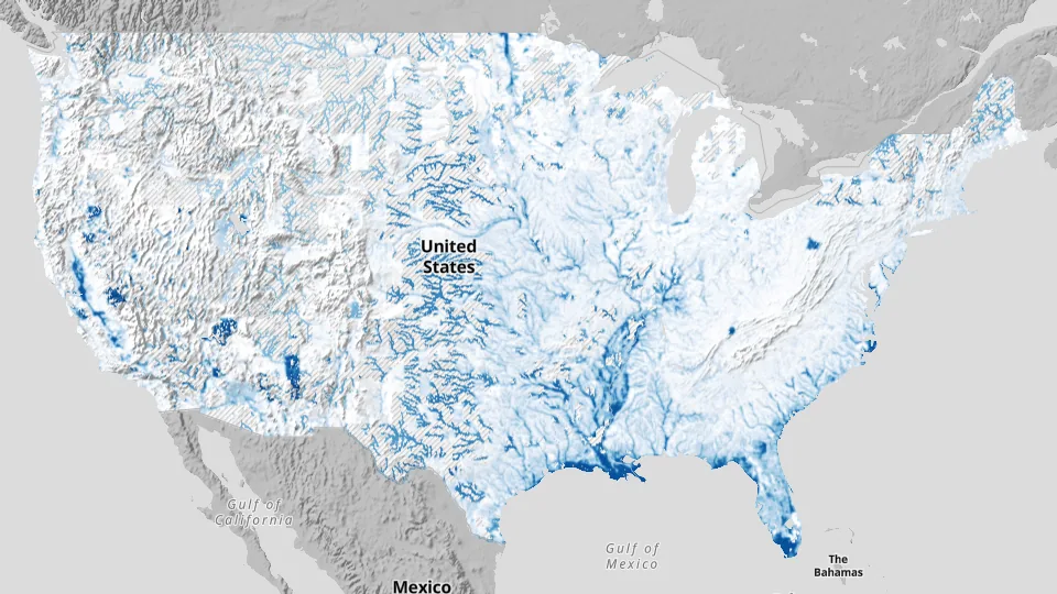
Questions about flooding in Teton Village
Is Teton Village in a flood zone?
Parts of Teton Village are: by BestNeighborhood's estimate, FEMA's high-risk flood zone holds 3.7% of its residents, 32 people.
Do I need flood insurance in Teton Village?
Federal law requires flood insurance on buildings in FEMA's high-risk zone in Teton Village that carry a mortgage from a federally regulated or insured lender; outside that zone the law does not require it. In Teton County, 3% of residential buildings carry a federal flood policy.
How often does it flood in Teton Village?
In FEMA's high-risk zone in Teton Village, a flood has at least a 1 in 4 chance over a 30-year mortgage.
What does flood zone AE mean? And zone X?
Zone AE is high-risk ground where FEMA has published flood heights, home to 3.7% of residents in Teton Village. Unshaded zone X is minimal-risk ground outside the 500-year floodplain, home to 94% of residents. Zone X inside a levee is moderate-risk ground, with a 0.2% to 1% chance of flooding each year, inside a levee system, home to 2.8% of residents.
How do I find the flood zone for my address in Teton Village?
The map of Teton Village above shows the zone street by street; zoom in to an address to read it. For the official zone that lenders and insurers use, FEMA's Flood Map Service Center at msc.fema.gov has the Flood Insurance Rate Map for Teton Village.
Does this flood map include street and basement flooding from heavy rain?
No, the map of Teton Village counts rivers and creeks on FEMA's scale, and rain that floods streets and basements away from a waterway is outside it.
Sources and method
BestNeighborhood's flood model reads FEMA's National Flood Hazard Layer at 10-meter detail and counts residents by 2020 Census block. Where FEMA has studied the ground, the value is FEMA's. Elsewhere the value is an estimate of what FEMA's map would show.
Claims and policies come from FEMA's National Flood Insurance Program records.
Limits
This page is not a flood determination; lenders and insurers use FEMA's Flood Insurance Rate Map.
Rain that floods streets and basements away from rivers and creeks is not counted.
The high-risk zone means a chance of 1% a year or more, and land right beside a river floods more often than that.
Each value is a mean over a small cell of ground, not a reading for one address.
Levees can fail or be overtopped.
Sources
Federal Emergency Management Agency (FEMA) National Flood Hazard Layer: Flood zones on the map, the share of residents in each zone and the dates of the map panels.
FEMA National Flood Insurance Program claims and policies (OpenFEMA): Paid flood claims, policies in force and their cost. This product uses FEMA's OpenFEMA API but is not endorsed by FEMA; FEMA and the federal government cannot vouch for analyses made from these data.
U.S. Army Corps of Engineers National Levee Database: The share of residents living inside levee systems.
U.S. Census Bureau 2020 Census blocks: Where residents live, so each figure counts people rather than land.
Last updated .
More about Teton Village
Coming soon: 2027 wildfire risk
A map of wildfire risk for the 2027 fire season is coming to this page for Teton Village, and to BestNeighborhood for the U.S.
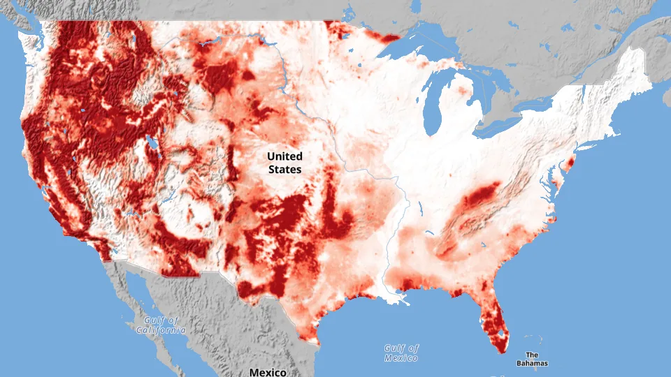
Early access is available now for businesses through paid CrimeGrade reports. Every report includes Disaster Grade Beta, with scores and maps at the report's address for each hazard listed below.
What a business report covers
- Flood
- Wildfire, this season and in a typical year
- Wind
- Tornado wind
- Earthquake
- Hail
- Heat
- Extreme cold