Bronze Boot leans heavily Democratic by roughly 36 points: about 68% of voters vote Democratic and 32% Republican.
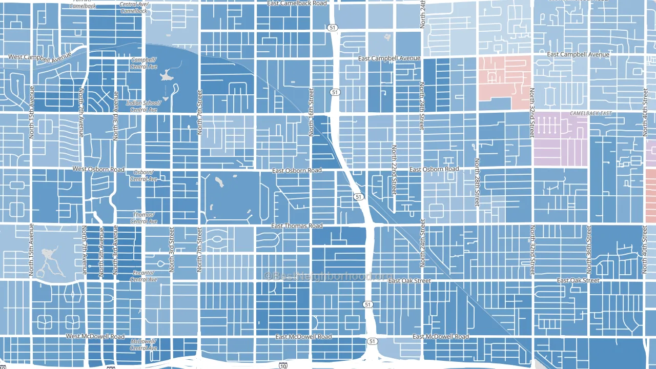
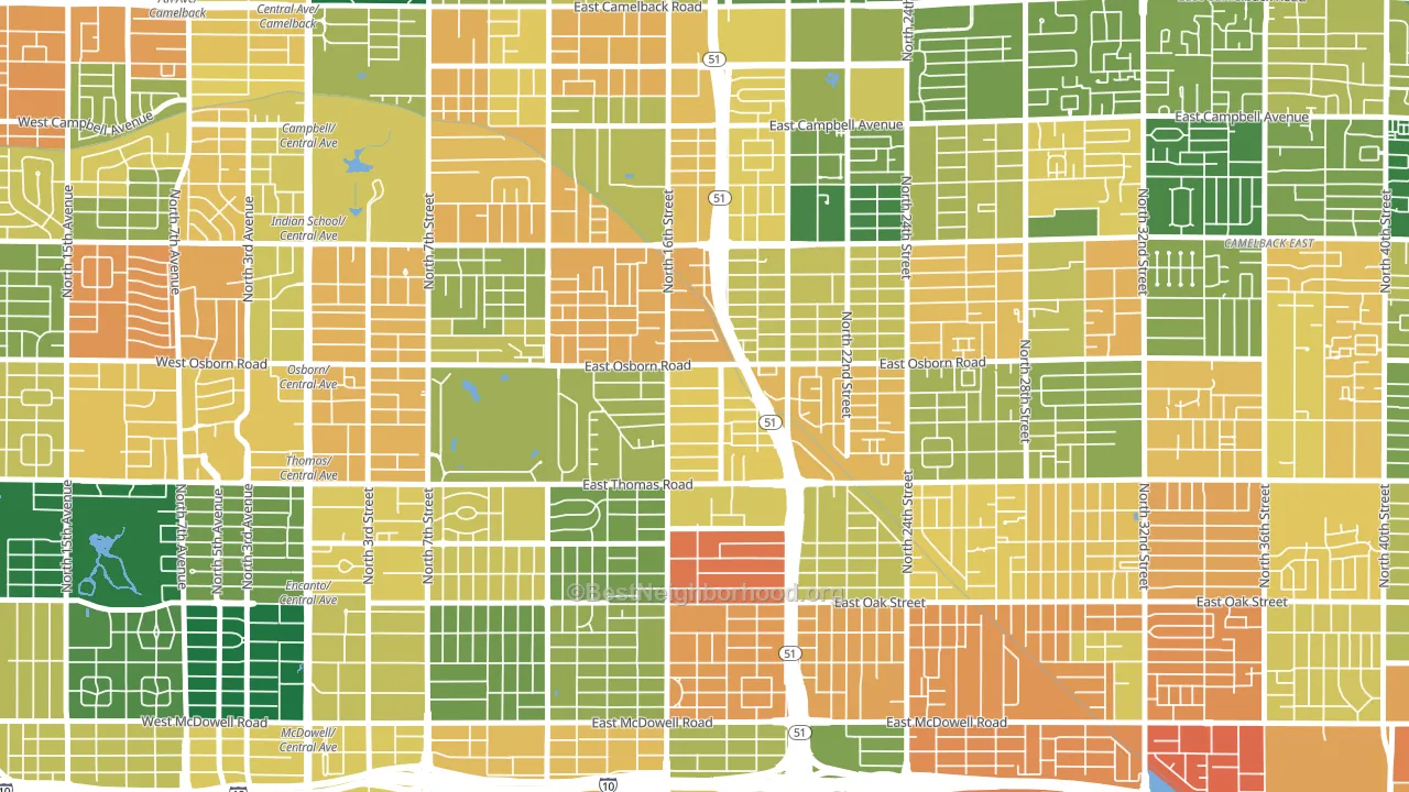
About 48% of adults in Bronze Boot typically vote, below the U.S. average of about 62%. Among adults in Bronze Boot, ~33% vote Democratic, ~15% Republican, and ~52% don't vote. The map below shows estimated turnout by block group.
How Bronze Boot compares
Among neighborhoods within 5 miles, Bronze Boot leans more Democratic than 2 of 5 neighbors.
Bronze Boot runs about 41 points more Democratic than Arizona as a whole. Arizona leans Republican overall, while Bronze Boot is one of the few Democratic-leaning pockets.
Why Bronze Boot leans the way it does
This analysis examined 14,881 data points per neighborhood to find what predicts political lean and turnout. The items below are a few correlations that stood out for Bronze Boot, not a ranked or complete list of what matters most.
Dense areas vote Democratic. More than 99% of residents in Bronze Boot live in densely developed areas, about 64 points above the U.S. average of 36%. A high never-married share predicts Democratic voting, and about 51% of adults in Bronze Boot have never been married, above 84% of neighborhoods. Bronze Boot runs against the grain of Arizona, a Democratic-leaning pocket in a Republican-leaning state.
Paved land cover and Democratic lean
Places with extensive paved surfaces tend to lean Democratic; Bronze Boot, Phoenix, AZ sits in the top quarter nationally on this measure. Paved ground does not change how people vote; it mostly reflects how urban and built-up a place is.
Why turnout in Bronze Boot looks the way it does
Areas with limited routine healthcare access turn out at lower rates. Bronze Boot is in the bottom quarter nationally for routine-care measures such as insurance coverage, preventive screenings, and dental visits. Crowded housing lines up with lower turnout, and about 8% of homes in Bronze Boot have more than one occupant per room, above 88% of neighborhoods. Learn more about the findings and methodology on the political spectrum map.
Nearby Neighborhoods
- Central Phoenix, Phoenix, AZ D+41
- Encanto, Phoenix, AZ D+38
- Camelback East, Phoenix, AZ D+24
- Downtown Phoenix, Phoenix, AZ D+45
- Alahambra, Phoenix, AZ D+27
- Sunset, Tempe, AZ D+41
- South Mountain, Phoenix, AZ D+35
- Riverside, Tempe, AZ D+42
- South Phoenix, Phoenix, AZ D+30
- South Scottsdale, Scottsdale, AZ D+7
Neighborhoods with Similar Populations
- Euclid-St Paul, St. Petersburg, FL D+18
- Queensborough, Shreveport, LA D+84
- University of NC at Chapel Hill, Chapel Hill, NC D+72
- Carondelet, St. Louis, MO D+51
- North Quinsigamond Village, Worcester, MA D+37
- Southgate, Hayward, CA D+39
- Abbott McKinley, Buffalo, NY D+16
- Crystal Springs, Jacksonville, FL R+3
- Gresham-Kelly Creek, Gresham, OR D+4
- Carquinez Heights, Vallejo, CA D+45
Sources and methodology
Precinct-level voting records used to fit the model come from Arizona Secretary of State, Elections, distributed by the Voting and Election Science Team. Demographic inputs come from the U.S. Census Bureau (ACS 5-year estimates and the 2020 Decennial Census). Health and environmental inputs come from the CDC (PLACES and the Environmental Justice Index). Land cover comes from the USGS and EPA. Election-day and lead-up weather come from PRISM 4km daily grids and the NOAA Global Historical Climatology Network. Mail-voting and election-administration patterns come from the MIT Election Lab's Survey of the Performance of American Elections. Block-group crime detail comes from CrimeGrade. Internet data and modeling support provided by ISPreports.org.
Modeling and analysis by the BestNeighborhood data science team. Full methodology and findings: political spectrum map.
Methodology reviewed by the BestNeighborhood data team. Last updated May 2026.